

“Perfection is a road, not a destination.”
Late July 2016 near Gunnison, Colorado
I am always on the lookout for a backcountry creek, preferably in a remote canyon or wilderness area, featuring great scenery, abundant wildflowers, and eager trout. I love that feeling of discovering an untrammeled piece of our planet Earth or at least one that is very lightly trodden.
I have had my eye on a little stream called Perfecto Creek and its partner Chavez Creek since last summer when I crossed over them to fish the headwaters of Cochetopa Creek high in the La Garita Wilderness 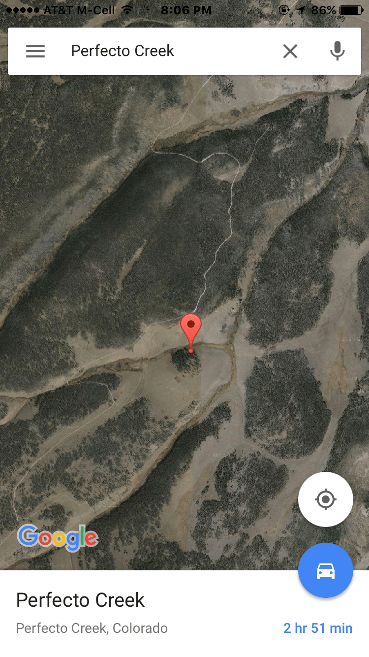 Area south of Gunnison, Colorado. With a name like Perfecto,
 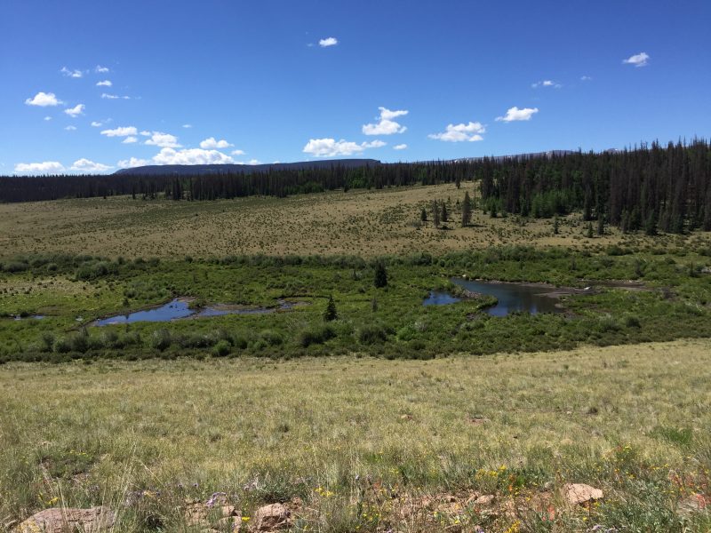 how can one resist?? Where the gravel U.S. Forest Service road crosses over, it’s barely a rivulet, but I spied some big inviting beaver ponds not too far below. And with some topographical map and GIS sleuthing, I find that just a mile down downstream Perfecto is joined by Chavez Creek then paired up they descend into a canyon on the way to a rendezvous with Pauline Creek (See my article on Pauline Creek from 2015.). That may mean enough water to float some decent-sized trout.

 from the rugged peaks along the Divide—like Cochetopa and Saguache Creeks– were finally down and in fishable shape after a very wet summer. But this new water was also on my radar. I had read about Pauline Creek in the fine guidebook, 49 Trout Streams of Southern Colorado, that the authors Mark Williams and Chad McPhail had stumbled on and raved about: “…rest assured, once a dry fly or beadhead breaks the surface, so will a trout.” When I drove over the creek on my way to fish in the wilderness area 10 miles up Forest Service Road 794, I was immediately skeptical. At that point, Pauline hardly amounts to rivulet status, only a few feet across, although some beaver ponds upstream looked interesting. That night, after a fabulous day casting to trout on Cochetopa Creek in the wilderness area, I pulled out a topo map (National Geographic #139 La Garita/Cochetopa Hills) and found that a few miles below the road where Pauline was hardly a trickle, several streams added their waters. That looked more promising, so early next morning around 7:30 a.m. I trundled down a 4wd track off FS 794 above where Pauline empties into Cochetopa Creek. The jeep trail ended abruptly at a big cliff. The good news as I peered over into the canyon was that the creek indeed had more water here, and the wide canyon floor was punctuated by several good-looking beaver ponds that were sure to hold some sizable trout. The bad news: My aging knees were already protesting at the thought of scampering down that precipitous incline—a good 200-foot drop—in my waders and wading boots and carrying a long fly rod.