Early October 2021
For my Day 1 outing on the Huerfano (the Orphan) River see: https://hooknfly.com/2021/10/14/exploring-the-hidden-creeks-of-the-sangre-de-cristo-mountains-day-1-on-the-orphan-river/
For accounts of earlier trips where I chased Rio Grande Cutthroats see: https://hooknfly.com/2021/09/14/prospecting-for-trout-on-the-fab-five-forks-of-the-conejos-river-2-the-adams-fork/ and https://hooknfly.com/2019/09/27/lake-fork-of-the-conejos-river-solitude-in-a-sanctuary-for-rare-rio-grande-cutthroat-trout/
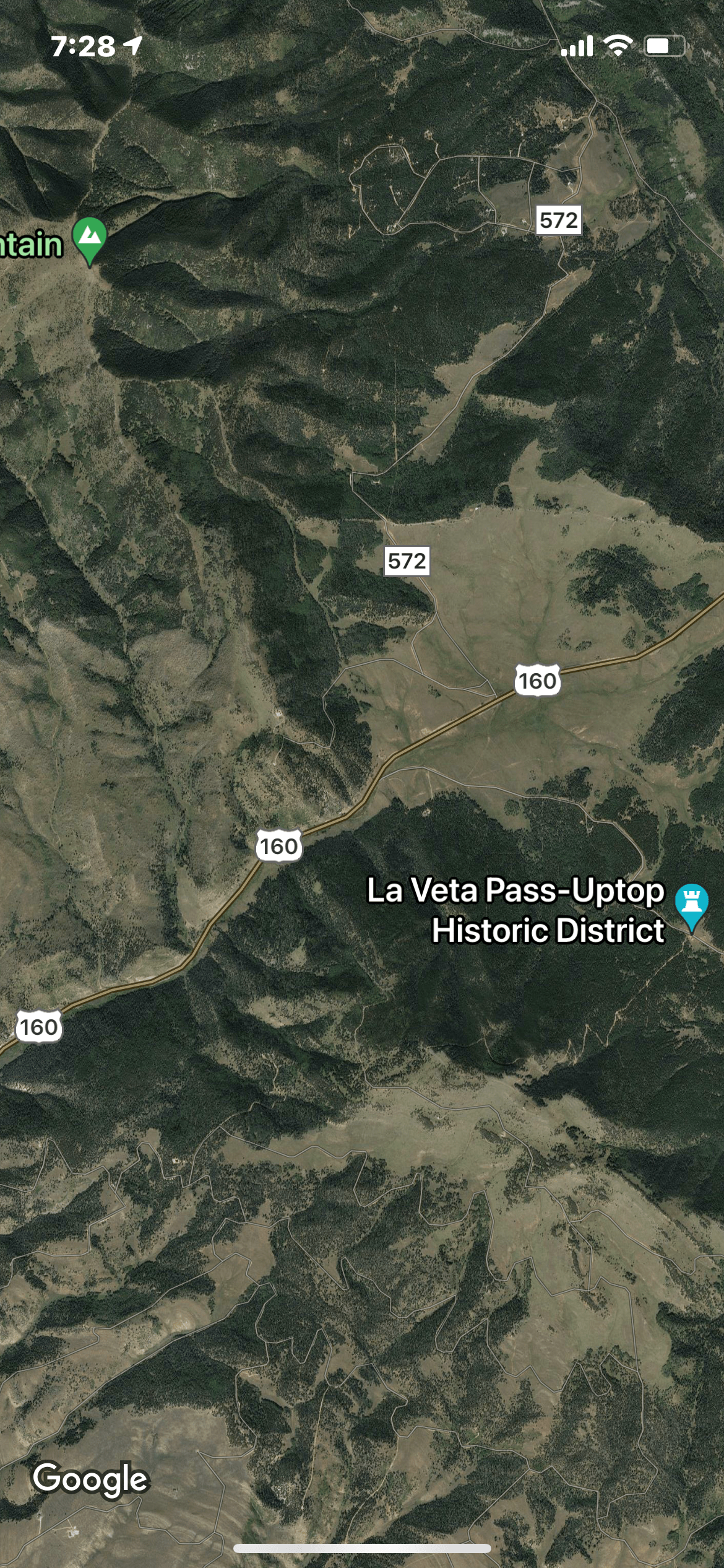
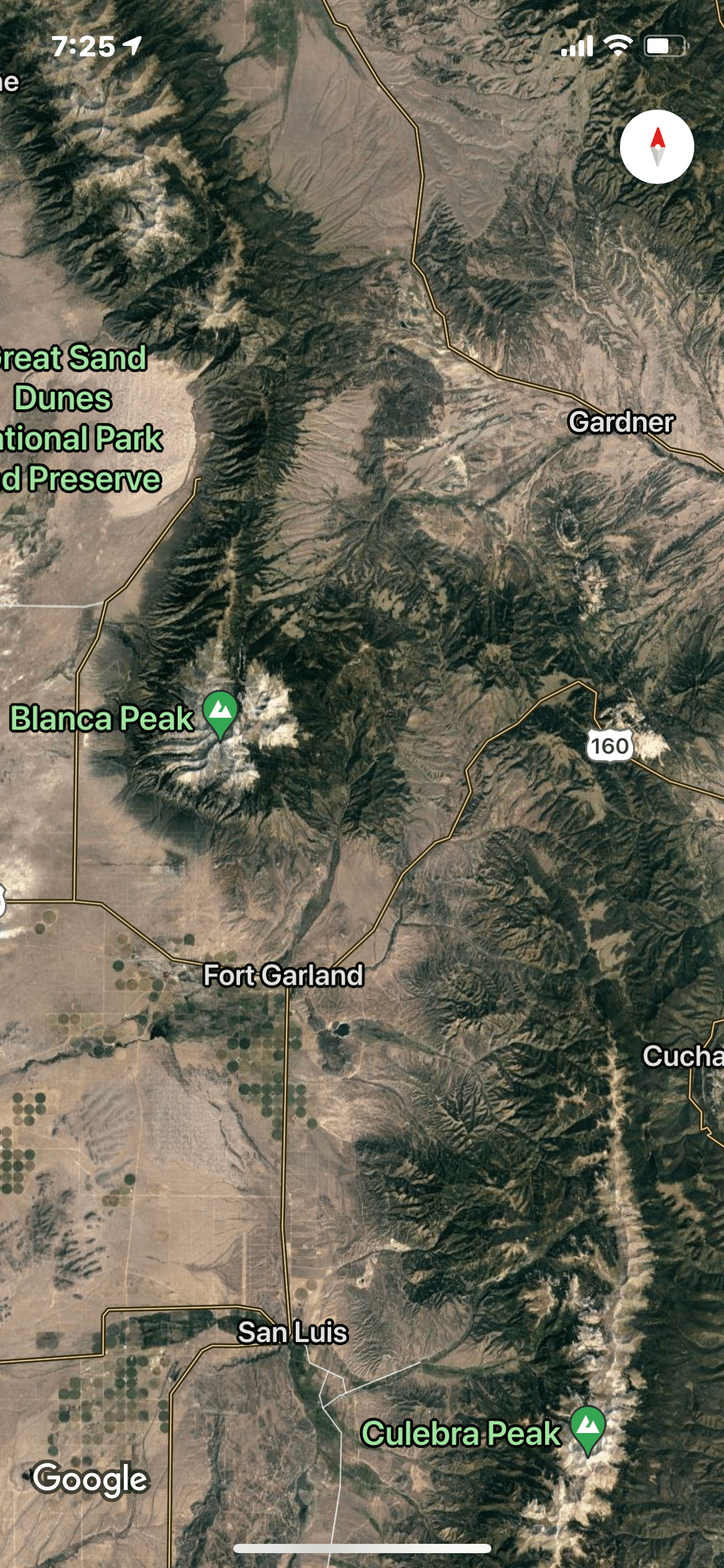
I’m off on my last camping/fishing trip of the year. Snow is already on the jagged peaks of the Sangre de Cristo (Blood of Christ) Mountains in the San Luis Valley, and colder weather will be rolling in next week. I have set up my mobile fish camp in an RV campground just outside of Alamosa, and have my eyes on two waters I haven’t yet explored in the remote high country of this imposing mountain range—the Huerfano (p. WEAR funno) River and Medano (p. MAY dunno) Creek. The Huerfano River lies on the east side of the Sangres where it springs from the flanks of the majestic Blanca Peak, a fourteener and one of the highest summits in the Rocky Mountains. The second, Medano Creek, lies only about 15 miles away as the crow flies to the north on the west side of the Sangres. It is home to the colorful, rare Rio Grande Cutthroats. While close on maps, the two waters actually lie a couple of hours apart by road.
The Sangre de Cristos are one of the most rugged mountain ranges in the United States climbing abruptly over 7,000 feet above the valleys to the east and west, one of the steepest vertical rises of any mountains in North America. Nine of its peaks top 14,000 feet. Unlike the San Juan Mountains on the west side of the San Luis Valley that were created by volcanic activity, the Sangre de Cristo range is the product of tremendous uplift forces which helps to explain their jagged profile. Numerous alpine lakes and streams are hidden away in the deep folds between the soaring peaks. Hiking in this rough high country is not for the faint of heart as I can attest from an outing on Sand Creek lakes several years ago.
Doing my due diligence research prior to this October trip, I found very little mention of either water on-line, except occasional posts by intrepid hikers. I couldn’t find anyone at my local fly shop who had heard of, let alone fished either. Apparently neither is on the angling radar screen—my kind of streams!
Day 2: Medano Creek
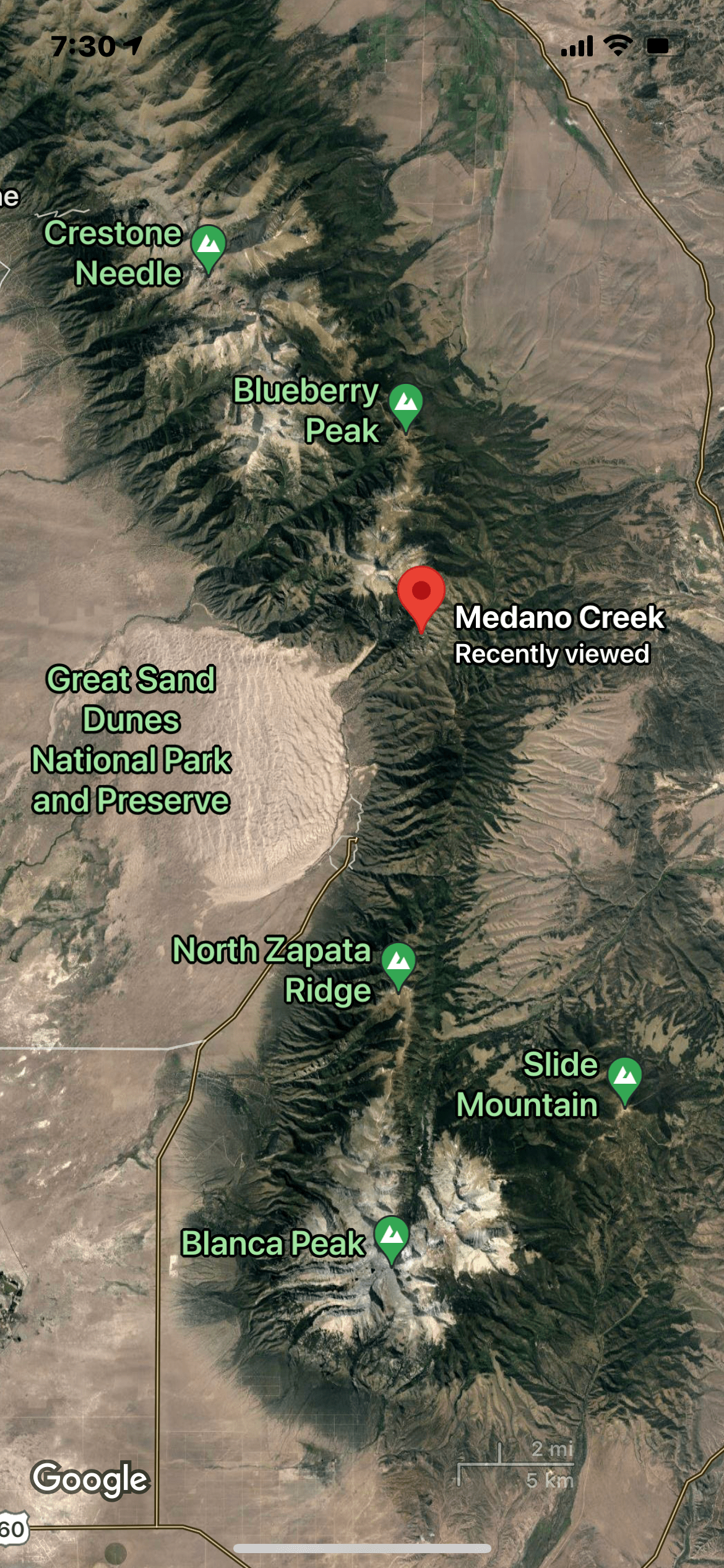
After a long day fishing the headwaters of the Huerfano River yesterday, I decide to sleep in a bit and have an extra cup of strong English Breakfast tea before heading out. Still I’m on the road by 8:30 a.m. for what should be the shorter drive to fish Medano Creek. Aptly named, meaning sand dunes in Spanish, Medano Creek flows through the Great Sand Dunes National Park and Preserve. The dunes there soar over 300 feet high, the tallest in North America. They fit in well with the San Luis Valley landscape, the highest true desert in the United States that gets a paltry eight inches of rain a year. Indeed, while Medano Creek starts out ten miles above the dunes in the Sangre de Cristo Mountains, it eventually disappears in the porous piles of sand. In the early summer when it still runs through the dunes before vanishing, my little sweetheart granddaughter Aly loves playing in the warm creek waters and digging in the huge natural sandbox.

Interestingly, biologists tells us that Medano Creek, being completely isolated by the dunes, never held any trout before nonnatives like brown trout were introduced. However, because of the isolation provided by the sand dunes, the creek was a perfect candidate for transplanting Rio Grande Cutthroats, the only native trout in the valley, as part of the recovery program to save that threatened fish. Non-native trout were poisoned out, and the Rio Grande Cutthroats introduced in the 1980s. The program was doing nicely until a huge wildfire burned through the area in 2010. Fortunately, state wildlife aquatic biologists organized to save fish in the lower reaches. The cutts in the creek rebounded nicely and are one of Colorado’s best sustaining population of the Rio Grande Cutts. They are now being used as the stock for restoration efforts such as those in nearby Sand Creek.
My excitement level jumps a notch as I get closer to the imposing sand dunes. This is definitely going to be a completely different day than yesterday. Instead of climbing high into the mountains on a steep rocky road to an alpine water at over 10,000 feet, I’ll be navigating tricky sand pits on the edge of the dunes that can suck even a 4WD drive vehicle to its axles in a flash. My first glimpse of the creek is encouraging, but I start to get a little knot in my stomach when I begin to see the increasingly sober warning signs as I drive further into the dunes.


One warns drivers to lower their tire pressure to 20 psi to make it through. Fortunately, according to the park ranger at the entry booth, soaking rains last night have firmed up the sand so I don’t need to follow that advisory. This won’t be so bad, I think. I’ll take a sandy road over a gnarly rock-infested steep one any day.

But then I come to the big sign that announces “point of no return!” Yikes, what have I gotten myself into?

Soon I run into what will be the first of several wide creek crossings. The water level is low so they are no problem, but could be earlier in the year during runoff.

I don’t see any fish, and the creek on either side is completely overgrown for several miles. I start to wonder if this is going to be another frustrating day like yesterday.
Further up another mile or so I run into a hunter near a series of steep cliffs, reputedly mountain sheep territory.

He confirms that is his quarry. The young nimrod says he has been at it for four days and hasn’t seen any. What about fish, I ask? He nods and tells me he’s seen plenty of those. Whew!
As I continue, looking for an opening to investigate the water, the still-sandy road narrows as it weaves its way through the aspen and pines. I wince as the branches scrape along the side of my SUV and snap at my radio antenna.

I start to wonder what I’ll do if I meet another vehicle. Then I do. That explains why I’ve been seeing short pull outs scraped into the forest every quarter mile or so. It’s where you back up to when you meet someone. Fortunately the young gents coming down are closer to one so they back up and pull over. I roll my window down to thank them, and ask what things look like above. They mention several more river crossings and then a rocky stretch a few miles up. I ask them if they saw any beaver ponds and they nod, just after the valley widens and the road gets rougher they say.
Their info proves to be correct, and sure enough right after the road begins to climb more sharply and the sand gives way to rocks in the road, the valley widens and I spy a side track that leads to a broad meadow where I can see water. It’s 10:30 a.m. and has taken me about two hours to drive here from the campground.
I hop out of the SUV and walk cautiously to the creek. It’s wide and flowing slowly courtesy of a small beaver dam below. I can see up the steep slope on the other side of the creek evidence of the massive forest fire that swept through here a decade ago.

Charred pine trunks still stand, but the aspen are coming back, and the vegetation around the pond is thick in places. There are dimples on the water, and as I get closer I can see several foot-long cutthroats swimming nonchalantly as they pick off small midge flies on the surface. I hustle back to my vehicle and grab the rod that’s rigged with a dry/dropper combo. The dry is a #18 Royal Coachman Trude and the dropper a creation of my own that I have dubbed Dirk’s Delight. It’s a #18 beadhead caddis larva that’s been producing all summer on small creeks.

I decide to don my chest waders, anticipating I will be wading beaver ponds today from the looks of things on Google Maps. But it’s nice and sunny—the temperature will reach 75 this afternoon—and the wind is light so I don’t have to slip on a jacket.
In a flash I’m back on the water, standing back from the shoreline so as not to spook the several cruising cutthroats. I make a short cast a few feet in front of the biggest, and he jets forward to nail the nymph before it can sink. BINGO! Not like the shy brookies yesterday! The handsome cutt poses for a quick photo then slides back into the water.

I quickly recast, and hook another. Indeed I get strikes on the next five casts and land a couple more smaller cutts, all but one on the caddis dropper.
When the action slows, I decide to hustle back to my vehicle and get my second rod rigged with two nymphs since the fish appear to prefer something subsurface. That seems to be the ticket, as the action picks up as I work upstream, the fish either being in the deeper trough in the middle of the slow moving channel or up against the opposite shoreline. The fish are definitely not being picky. I catch several that hit the dropper several times after being hooked on the first try but wriggling off.
Around the bend I spy several more cutts cruising along the surface steadily feeding on small tidbits. They aren’t wary and don’t waste any time nailing the caddis or the dry I offer a few yards in front of them. All are healthy and go from 10-12 inches. What fun! At the next bend in a deeper spot under an overhanging bush I’m surprised to get a beauty that pushes 14-inches, and then four more out of the same spot despite all the commotion.

Then it’s on to a big beaver dam and pond I can see upstream. I approach the dam cautiously and cast the flies into the spillway cascade. Immediately something big nails the dry and the battle is on…but short-lived. The cutthroat cartwheels into the air, his sides shining in the sun, and earns his freedom as I magnanimously grant him a long-distance release.
I move up and carefully scale the big beaver dam. It doesn’t take long to get back into the groove. On the first cast parallel to the dam into a pocket under some overhanding trees, a colorful cutthroat inhales the nymph.

Several more come out of that spot. Next I concentrate on a dark, deeper hole in the middle of the pond where a couple of fish are dimpling the surface. It produces several more, but all on the nymph. For the next half hour I work the pond from the shoreline. I get several more cruisers on the dry, one of which I watch incredulously as he hits the dry, then the dropper, then the dry again five times. I actually hook him twice, and he just keeps coming back. Who am I to argue?!? Further on I see a rise in a deep pocket close to the shoreline, and it turns out to be a honey hole. I fool a half dozen more feisty cutts including a long, slim beauty that pushes 14-inches!

By now it’s almost 2 p.m., and my stomach is growling. But just as I’m about to head back to the SUV and lunch, I come upon another beaver dam, this one older and smaller, with a pond that’s partially silted in. I catch several below the dam, then realize I’ll have to navigate around the marshy area it has created to get to the deeper water above. I go back downstream a hundred yards and am just about to take a step into a clear, shallow side channel when I am startled to see a leviathan slowly finning in the narrow confines, picking morsels off the surface. I retreat behind a bush and gently loft a short cast a few feet in front of the big boy. He swims forward slowly and sips in the dry. I set the hook and he thrashes his head back and forth. My heart drops when the fly comes whizzing back towards me. I expect to see the fish zoom off back into the safety of the pond but he resumes his slow amble up the channel. I place the flies above him again, and he jets forward to nail the nymph. I’m so shocked that I momentarily forget to set the hook, but when I do the cutt shows off his muscles. He slashes back and forth in the channel, but luckily doesn’t make a run towards the pond which would have required me to do my famous Usain Bolt imitation running through the marshy muck to keep up with him. Soon he’s easing into my net, a stunning 15-inches. The big fish sports all the striking colors and patterns of a pure Rio Grande Cutt, including the cluster of small spots near the tail, the speckled back, the dark red gill plate, and of course the red slash under his throat.

As I slide the beautiful fish back into the water, I think what a wonderful way to end an extraordinary day!


But then think am I out of my mind with that one more alluring pool just above and Google Maps showing another whole series of ponds just up the road. So I negotiate with myself and my stomach. I’ll fish the pool then call it a day. The next string of beaver ponds can wait for a return engagement. The compromise turns out to be a good one. I catch several more nice fish at the top of the pond in very clear water, then resolutely climb up to the road above, tip my hat to the cutts, and hike a few minutes back to the SUV and lunch while I plot my return next year.

Note: In my follow up research on access to Medano Creek, I learned an easier route may be from the west side of the Sangres through the Wet Mountain Valley and over Medano Pass. Road 559 appears to be less challenging, gets to the beaver ponds more quickly, and avoids having to navigate the sand. UPDATE: The Medano Pass route is 4wd only, steep, and very rough and rocky in spots. Choose your poison.