Daily Double–A long shot bet won by choosing winners in two consecutive races.
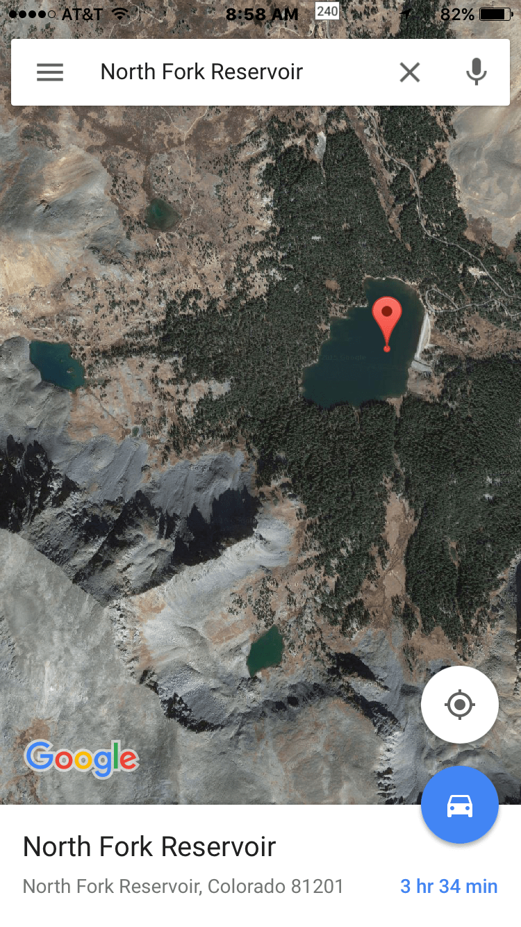
I am always on the lookout for a new, scenic, out-of-the-way creek overlooked and rarely visited by other anglers, where there is solitude and hungry fish. But sometimes the little gems are hiding in plain sight. That’s the case with 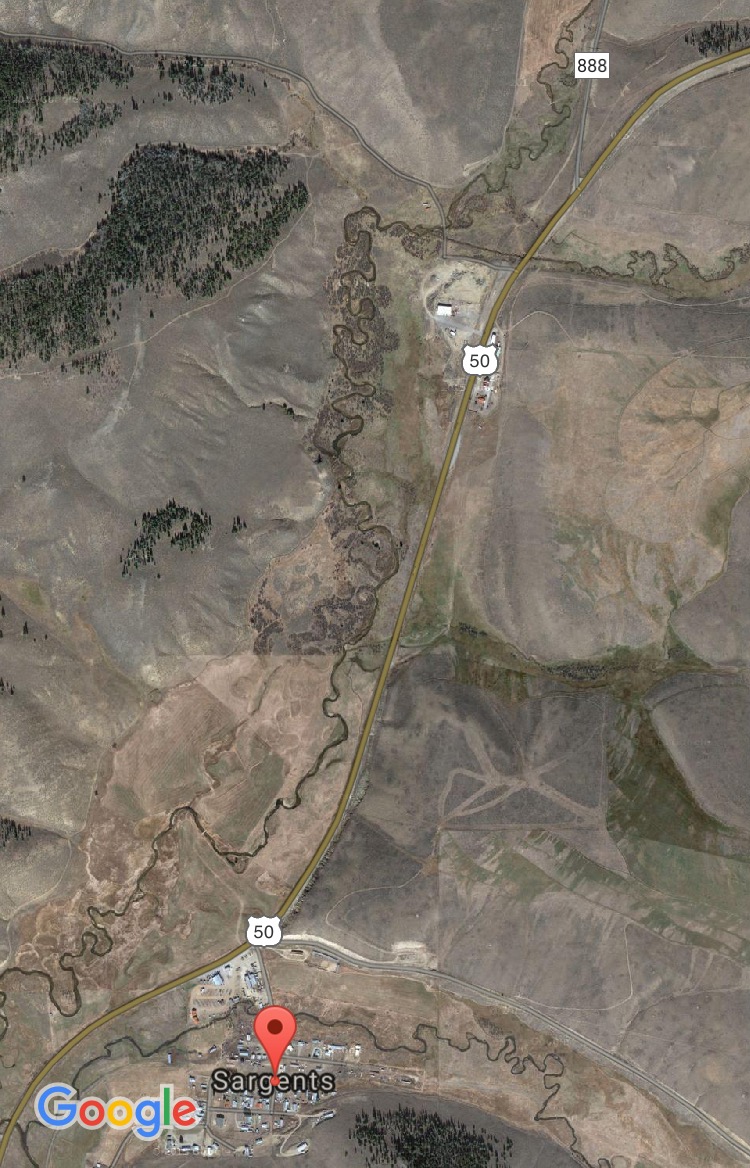 the upper reaches of Tomichi Creek, just over Monarch Pass from my cabin near Salida, Colorado. I have hustled by the creek many times on the way to fish fabled waters like the Gunnison River or my favorite backcountry streams like Cochetopa Creek. As you come bombing down the twisty, turny U.S. 50 from one of the highest paved vehicle passes in the USA, you descend into a lovely valley where gorgeous little Tomichi Creek flows through private ranchland–visible and within a stone’s throw of this major highway. But last fall on my way to Cochetopa Creek, I noticed a sign on a fence along the highway declaring special access, so I turned around and took a look. I was surprised to find that the Colorado State Land
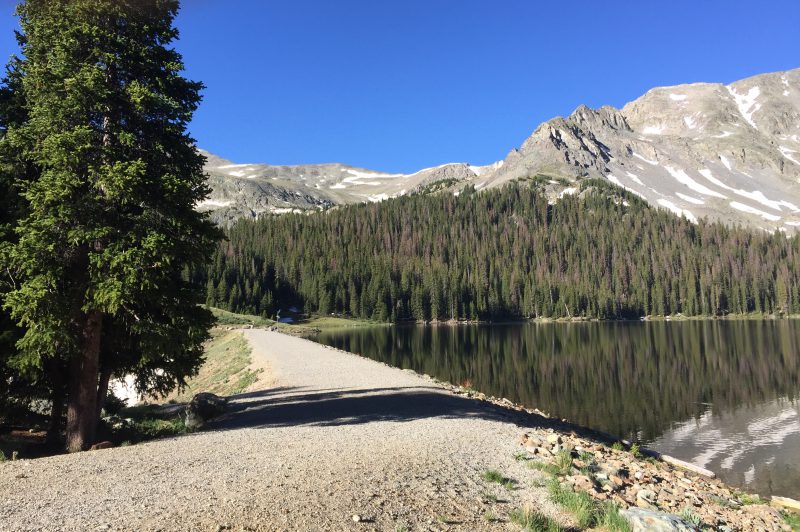
 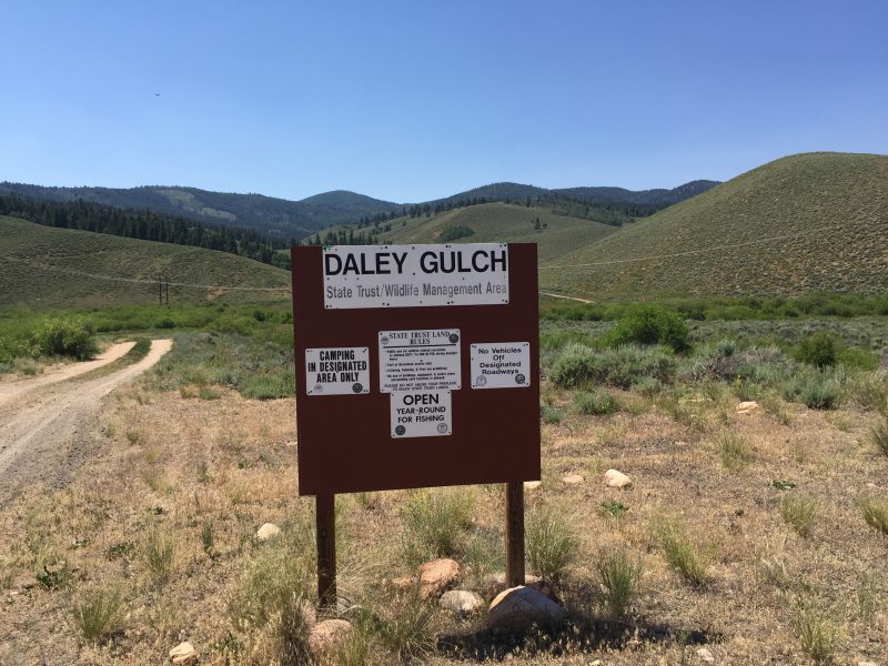 Board owns a full section along the road called Daley Gulch, and it was open to fishing. I tucked away that information till early July this year when I was hankering for a mid-week trout fix but had to be back home for a conference call by 4 p.m. Oh those pesky clients! I figured if I left early and was on the water by 8:30 a.m. I could fish till 1 or 2 p.m. and make it back to the office with ease. Now this was admittedly a long shot–a little like the Daily Doubles I used to bet on at Arlington Park in Chicago. The creek is very small as it flows through Daley Gulch, and with public access so close to a major highway I expected it probably got plenty of pressure. But with high hopes, that evening I rigged two rods, got the waders and boots out, set the alarm, and hit the rack with chubby trout dancing in my head.