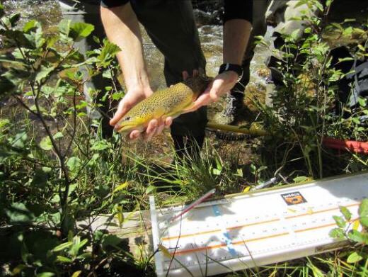
Badger Creek Act Deux: Steer Creek To Gribbles Run (near Salida, CO)

A friend once made the heartening observation—

“It is always easy to say something nice about fishing.”   Charles Goodspeed 

June 2018                                                                                                                      

Note:  For Act One and other outings on Badger Creek, see my October and December 2017 articles about fall fishing on Badger Creek.

https://hooknfly.com/2017/12/05/badger-creek-legend-of-the-late-fall-1-near-salida-co/amp/

 Late last fall I explored the upper reaches of Badger Creek just off the Ute Trail in Gribbles Park, about an hour’s drive from Salida.  I had an interesting day boulder hopping downstream for about a mile to where the little rivulet Steer Creek gurgles down the hillside into Badger.  I fished back upstream through a series of beautiful pools and caught a couple of dozen brownies, a few going 13 inches.  Now I’m back aiming to explore the second mile of the creek as it continues its journey through a scenic canyon to join the Arkansas River 15 miles downstream.

I’m on the road early at 7 a.m., the forecast for more dry, sunny and warm weather.  I’m kicking up dust clouds on Chaffee County Road 175/82 and then the Ute Trail (Fremont County Road 2), reflecting the serious drought gripping the region.  I haven’t been able to check the water level on Badger Creek since there is no state or federal flow gauges, so I have more than a little trepidation that there may not be enough water to float a trout.
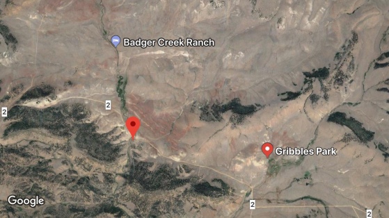
img_1054
Red Marker On Left Indicates BLM Parking Area On Badger Creek

The drive is as scenic as I remembered it, and the first view of Gribbles Park where Badger Creek arises, is a stunner, a quintessential western landscape with a broad valley, ridges, and peaks in the distance.

img_0832
Gribbles Park Vista

The Badger Creek basin is chock full of history.  The Utes hunted here as witnessed by the discovery of a buffalo jump, a cliff formation used by the Utes to drive herds en masse to their death.  One of the nearby peaks is reputed to be where they held vision quests.  Ira Mulock rode into the valley in 1870s with a herd of cattle up from Texas and started the historic IM Ranch, one of the first mountain spreads in this part of Colorado.  Tales of range wars over grass and water followed.  Today it is operated as Badger Creek Ranch, a working cattle/dude ranch. Lon and Badger Gribble were two other prominent early ranchers, leaving their names on the valley and the creek itself.

My first glimpse of the creek as it parallels the Ute Trail is not encouraging.  It never runs heavy, except after a big rain, but it’s hardly a trickle, and the flow is a sickly cloudy green.  I cross over the creek and take a right off of the Ute Trail into a sizable parking area on BLM land.
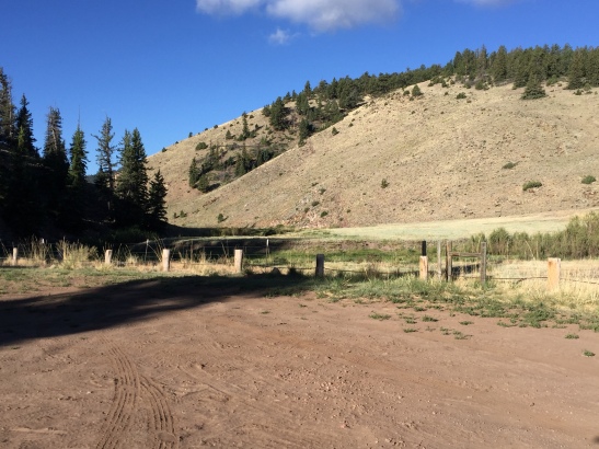
img_0833
BLM Parking Area Off The Ute Trail Just After Road Cross Badger Creek

It’s taken me over an hour to make the drive so I’m anxious to get on the trail.  I could probably wet wade, but knowing there are some deep pools, I decide to pull on my lightweight chest waders and new Simms Vapor boots, the best designed wading/hiking boots I’ve ever owned—very comfortable if you intend to take a long walk in to a stream as I often do.  I navigate through the sturdy fence in the designated spot, then catch my first glimpse of the creek.  While I was prepared for low water, my jaw still drops.  A toddler could jump over the creek.

img_0882-1
First Impressions Can Be Deceiving…Keep The Faith!

But I know things will get better only a quarter mile or so downstream where at the bottom of a cliff the Big Springs kick in.  Sure enough, as I round the first bend and walk into the meadow, I see flotillas of vegetation around the mouth of the spring and hear a little bit of a roar.  Hallelujah.  There’s even more water than last fall—I estimate the creek is running somewhere between 15 and 20 cfs, plenty of water, and it’s cold and clear.

As I follow the trail on the north side of the creek up and down over a couple of ridges, I vow not to stop and sample the pools below that produced some good trout last fall.  I have a lot of ground to cover—over two miles–down to Gribbles Run meadow.  I am already huffing and puffing, as the creek takes a hard turn to the south, and the trail descends to a stream crossing at the edge of a boulder field.

img_0878
Alluring Boulder Strewn Pools Of Upper Badger Creek

This calls  for my best mountain goat imitation to scale the rocks on the other bank.  Caveat:  Make sure you bring a hiking or wading staff—you’ll be glad you did, especially for the hike down to Steer Creek.

I’m a little winded now, and losing my resolve, decide to take a short break and sample one of the tempting pools upstream of Steer Creek.  Glad I did.  As my #16 Royal Coachman Trude bobs jauntily down through a  good-looking pool, it suddenly disappears, and I am onto a nice brownie that ate the #18 green hotwire CDC caddis nymph, one of my own creations.  Great start!


I manage to catch another smaller one before I hang up my dropper in some of the tall, lush streamside grass.  And it won’t let go no matter what I do.  The grass will plague me all day when I fail to watch my backcast carefully on this narrow little stream.

I continue downstream and then cross back to the west side of Badger and step over little bubbling Steer Creek.  My resolve is again tested as I continue downstream and wade past a couple of enticing, deep emerald-green pools where I can see dozens of fish finning, finally emerging into what I call Ponderosa Park.  Here the canyon walls start to recede a bit, and the creek starts to change character, more of a meadow water with shallow, fast glassy runs and fewer boulders and plunge pools than above.  This is a great spot for lunch, so I stow my little cooler under a beautiful spruce tree in the middle of the park that provides shade and seclusion.

img_0870
Great Shady Lunch Spot Under Giant Spruce In Ponderosa Park

Of course I have to sample the creek again, and quickly catch a couple of small, energetic brownies in a straight shallow run, one taking the dry and the other the nymph.


It’s here that I start to notice a lot more aquatic vegetation including the infamous Badger Creek Yellow-Green Blobs.  These mats of moss and goo reportedly take over the creek by late summer.  Today they are a minor annoyance, sometimes eating my fly at the end of a drift.

I continue down the trail until it emerges into a broad meadow where Gribbles Run cuts in from the east.  Of course it’s bone dry.  Badger Creek is dramatically different here.  It’s flowing clean and clear, but is more like an eastern spring creek, filled with rafts of floating and submerged vegetation waving in the current, with narrow slots of open water in between.


I step into the creek below a little riffle and several nice trout shoot out from under the rafts as well as the undercut banks.  Yikes, this is going to be a challenge.  A fish is rising at the top of the pool, so I loft a cast into the swirl, and immediately hook a nice trout that proceeds to dive into the vegetative sanctuary.  When I finally work my way up to my fly, of course the fish has twisted off.  The next pool results in my nymph dredging one of the green blobs.  As does the next, coating my hook with riverbed detritus.  Fish are rising, indeed jumping out of the water, but ignoring my Trude. Then I see the proverbial sign from above—a hazy cloud of little black Trico mayflies hovering upstream over the next pool.  I can tell there is going to have to be an attitude and fly readjustment at this point.

img_0887
Tiny Trico Mayflies Ring Dinnerbell For Trout

I tie on a new rig that has worked well on similar waters like Archuleta Creek, a spring-creek like tributary of Cochetopa Creek near Gunnison, Colorado (See my August 2016 article.).  I tie on a little #20 foam parachute midge that imitates the Tricos trailed 18-inches below by a #18 red zebra midge.

img_1062
Below Steer Creek The Black Foam Midge And Red Zebra Nymph (Right and Left) Replace The Trude and Beadhead Caddis As The Go-To Flies (Top and Bottom)

I usually tie my droppers 30-inches below the dry I’m using, but shorten it here to avoid snagging the nymph on shoreline grass when trying to place the dry next to the bank.  Also, the shorter dropper means it is less likely to get caught up in the submerged stream vegetation.  The midge is virtually invisible to the eye on the water, so I tie on a small piece of yellow yarn as a strike indicator about three feet above the dry.  I then sneak up slowly on the next pool where a couple of trout are rising.


My first cast alights delicately in the streamside grass, a full five feet from my intended target.  But by the grace of the angling gods, it does not snag and somehow manages to end up in the creek when I give it a prayerful jerk.  And WHAM!  A nice 13-inch brownie cannot resist the dry, and as he cavorts about one of his buddies nails the nymph.  A double!!  I have cracked the code!!

The small dry does not spook the fish in the shallower, crystal clear water, and the tiny zebra midge doesn’t sink as fast as the bigger caddis nymph and thereby avoids getting swallowed up on the submerged vegetation—or at least not as often.   For the next couple of hours I have a blast catching eager brownies in every run and every pool.  Most only go 6-11 inches, but a few healthy 12-13 inchers come to the net.

img_0854
Brownies Below Steer Creek Can’t Resist New Fly Combo

As with most small canyon creeks, stealth is still a key.  I do my best to kneel when casting in the creek or get out of the water and cast from the shore where possible.  I still spook a lot of fish—the number of trout in this little creek is astounding, and I see and scare a couple of lunkers that would go 15-inches.

By the time I reach my lunch cooler in Ponderosa Park at 2:30 p.m., I am famished and in need of a good rest.  As I age, I force myself to take 30 minutes for lunch versus the ten minutes allotted in my foolish youth.  Sitting in the shade under the giant spruce, I reflect on how Badger Creek went from a basket case in the 1980s to a beautiful, well-managed water it is today full of well-fed fish.  The great recovery started, as is often the case, after a catastrophic natural disaster.  A major rainstorm hit the area in 1979 and as a result of overgrazing and poor conservation management on both public and private lands upstream, unleashed a tremendous flood.  The flow in the canyon was estimated at 10,000 CFS—that’s five times the flow the mighty Arkansas River carries during spring runoff.  The canyon was scoured and tons of sediment deposited downstream.  In the wake of the flood, federal land managers got together with state officials and local ranchers and worked on a landmark cooperative restoration plan.  Ranchers were offered incentives in the form of cost sharing to fence off significant stretches of the creek from cattle that can trample a streambank into oblivion in a flash.  Ranchers also agreed to rotate their herds to reduce overgrazing, and shorelines were repaired with plantings.  The results can be seen today.  Badger Creek below the Ute Trail has come roaring back!  Not surprisingly, the creek is becoming better known among angling aficionados, but the farther I hiked down the canyon, the fewer boot marks I see and don’t run into any living soul all day!

After downing one last swig of my elixir, a can of venerable RC Cola, I hit the creek again.  It’s getting late, the sun starting to sink behind the cliffs to the west–but I still have those big deep pools just above Ponderosa Park to sample, and I won’t go home until I do.  I mosey down to the creek and am treated to one of those unexpected delights of nature that turn a good day into a memorable–a flight of blue darners, one of my favorite dragonflies, is holding a love-in!  What a sight!!


I finally tear myself away from the love bugs and proceed upstream.  I catch several good ones in the first deep pool below a little waterfall.  I proceed to work up to the waterfall where the water is over my waist, and peer into the pool above.  Trout are rising steadily.  I have to execute a tricky backhand cast upstream around a boulder to land the fly in the current, but when I do succeed every time a good trout blasts either  the dry or nymph.  Six trout come out of that beautiful little pool.

img_0864
Back-hand Cast Around Boulder = Six Brownies

Then further upstream I arrive at the honey hole that I had crossed just below Steer Creek earlier in the day.  I can see over a dozen smaller fish finning nonchalantly in the shallows below a pool so deep I can’t see the bottom.  I decide to cast over the little guys, hoping I don’t send them fleeing to tattle on me to the bigger ones above.  The flies land in the riffle at the head of the pool, and the faux Trico swirls into the deeper water, then bounces against big boulder that deflects the current.  I watch, mesmerized by the picture-perfect scene, then notice the strike indicator is gone!  I set the hook and feel a good trout shaking his head in the depths.  He slashes back and forth in the pool, giving me time to grab my cell phone from my vest and shoot a video of the fight.  He’s a game one and puts on a good show.  One of the biggest of the day!


Now I vow in earnest that he will be the last one.  I have a good half-hour uphill hike in front of me to get back to the SUV and then another hour drive to my cabin in Salida, so need to rock and roll.  But dang, only 10 minutes into the return hike, I spot a pool I fished successfully last fall that has fish dimpling the surface everywhere.  I lecture myself that this will absolutely be the last cast (if I get a fish). And I do.  I wait for a good one to rise, let him settle for a bit, then lay my fly a few feet above where he had shown himself.  And right on cue, the beauty surfaces and gulps in the midge dry.  After a good tussle, the big brownie comes to the net for a quick photo and release.


I am smiling broadly—always a good feeling to catch a good fish on that last cast of the day.  I tip my hat to Badger Creek as I hustle back to the parking lot and scoot back to Salida.  Act Deux on Badger Creek has been a good one.  I can’t quibble with what goes on in Gribbles.

img_0865
Angling Gods Bestow Blessings On Hard-Working Anglers!
img_0886-1
Back At Cabin Recuperating with Dr. Jose Cuervo

Note:  For information about accommodations and fishing at nearby Badger Creek Ranch, call 719-837-2962.
Day 2.5 Of The Tomichi Creek Trifecta: Exploring The Headwaters (near Gunnison, CO)

I am always on the lookout for a new, scenic, out-of-the-way creek overlooked and rarely visited by other anglers, where there is solitude and hungry fish.  But sometimes the little gems are hiding in plain sight.  That’s the case with the upper reaches of Tomichi Creek, just over Monarch Pass from my cabin near Salida, Colorado.  I have hustled by the creek many times on the way to fish fabled waters like the Gunnison River or my favorite backcountry streams like Cochetopa Creek.  As you come bombing down the twisty, turny U.S. 50 from one of the highest paved vehicle passes in the USA, you descend into a lovely valley where gorgeous little Tomichi Creek flows through private ranchland–visible and within a stone’s throw of this major highway.  But awhile back on my way to Cochetopa Creek, I noticed a sign on a fence along the highway declaring special access, so I turned around and took a look.  I was surprised to find that the Colorado State Land Board owns a full section along the road called Daley Gulch near the hamlet of Sargents, and it was open to fishing.  I tucked away that information till a year later when I was hankering for a mid-week trout fix but had to be back home for a conference call by 4 p.m.  Oh those pesky clients!  I figured if I left early and was on the water by 8:30 a.m. I could fish till 1 or 2 p.m. and make it back to the office with ease.  Now this was admittedly a long shot–a little like the Trifectas and Daily Doubles I used to bet on at Arlington Park in Chicago.  The creek is very small as it flows through Daley Gulch, and with public access so close to a major highway I expected it probably got plenty of pressure.  But with high hopes, that evening I rigged two rods, got the waders and boots out, set the alarm, and hit the rack with chubby trout dancing in my head.

Day 1:  Daley Double On Tomichi Creek–See my July 2016 article on fishing Tomichi Creek at Daley Gulch 

Day 2:  Tomichi Creek:  Hidden In Plain Sight—The Lower Canyon Section—See my June 2018 article on fishing Tomichi Creek below Sargents, Colorado.  

Day 2.5:  Exploring The Tomichi Creek Headwaters 

After a good half-day of angling for scrappy brown trout in the canyon stretch of Tomichi Creek below Sargents, Colorado, I decide to drive up to the headwards—about 9 miles north of the town.  The colorfully named U.S. Forest Service Snowblind Campground is my destination for a late lunch before I explore the upper reaches of the creek.

The turnoff for County Road 888 is just over a mile north of Sargents off of U.S. 50.  Then it’s a scenic drive through the Cross Bar Ranch, a well-tended working spread.  I nearly bump into a momma cow and her calf as I salivate over the picturesque creek wending its way through the valley.

img_0649
How Now Black Cow?!

The ranch is reportedly owned by a millionaire businessman out of Miami, and there is no fishing access for the public until you reach the campground, about nine miles from the U.S. 50 turnoff.

The pavement ends about three miles up followed by six miles of a decent gravel road.  The county road crosses Tomichi Creek just before it reaches the campground.  Up here at about 9,000 feet elevation, it is rollicking little mountain freestone water, with canyon walls starting to pinch in and spruce and pines covering the slopes.

img_1048
Tomichi Creek Headwaters Fishing Starts At Snowblind Campground

The campground is a so-called “primitive” one because it has only vault toilets and water.  No 50 amp hookups for those roughing it in 40-foot RVs!  But a nice little travel trailer or tent would be just perfect in this well-laid out facility.  The bonus is that Tomichi Creek runs right through the middle.  There were plenty of open sites this day, so I got get one right next to the creek for my lunch break.

img_0650
Attractive Snowblind Campground Is A Good Base To Explore The Tomichi Creek Headwaters

Very relaxing and just what I needed after the ordeal of having to land all those fish earlier in the day.

After lunch I reconnoiter upstream.  A mile or so up the road I pass the well-tended White Pine cemetery then in another mile the former ghost town of White Pine, now a little village of summer homes.

There is a lot of history up here, mostly related to mining.  Silver was discovered in 1878, and a boom let to the creation of White Pine, named for the dense stands of pine on the surrounding slopes.  The boom peaked in 1884 when the town had almost 1,000 people, a newspaper, three saloons and several hotels.

img_0917-1
Hearty Miners Of White Pine

It’s hard to imagine all that development shoehorned into this cramped valley.  Indeed the tough topography made building a challenge and transportation in and out a travail , not to mention deadly avalanches.  When the Silver Panic hit in 1893, White Pine soon became a ghost down.  There was a revival in the early 1900s when the Akron Mining Company drove an almost mile-long tunnel into nearby Lake Hill and pulled out coal and zinc.  The mine continued in operation until the 1950s, supplying critical metals like zinc, lead, and copper in two World Wars.  When the mine closed, White Pine again faded.

Of course what got left behind was a legacy of pollution and scars upon the land, a story repeated throughout Colorado and the West.  Toxic sediment from a huge pile of waste rock and mine tailings  that abutted the creek near White Pine for years damaged the trout population in the Tomichi.  Downstream the Tomichi Mill site on the stream was also heavily polluted.

img_0914
Mine Tailings Along Creek

The fish—browns and brookies—were still there, somehow managing to survive, but the long-term future of any aquatic life in the upper Tomichi was dim.  That is until the U.S. Forest Service and U.S. EPA teamed with other agencies and Colorado Trout Unlimited in 2015 to clean things up.  This award-winning $1.5 million major earth-moving and remediation project, has recently been successfully completed and things are looking up and the results are promising.  The photos below depict the heavy earth moving required and before and after conditions.  (These project photos are from an excellent 2017 article on the remediation efforts by Jason Willis, the Trout Unlimited project manager, available on-line.).

Not that things are completely hunky dory.  When I start to explore a promising stretch of the creek below White Pine, I find very few bugs in the water—almost no mayfly nymphs and a few caddis nymphs here and there.  Further downstream around Sargents the predominant bug is still the caddis which can withstand pollution better than mayflies, indicating that heavy metal pollutants are likely still present courtesy of the upstream mines.  But the fish are there in the headwaters, as witnessed by electroshocking done prior to the remediation project.

img_0919
Pre-project Electroshocking Results Shocked The Shockers:  Big Brownie

This is no stream for beginners, especially between the campground and White Pine.  Rarely will you flip a cast longer than the length of your leader.  The creek is mostly fast-moving water with tiny pockets where the fish hide.

My first little brownie flashed out lickety-split to nail my #16 Royal Coachman Trude, but any bushy high-floater will do.  I also get one on a small #18 green hotwire caddis nymph trailing a foot under the dry—any longer dropper will just result in more snags in the willows and assorted trees and brush crowding the creek.

img_0473
Patience And Persistence Will Be Rewarded

You will get snagged and probably break off a fly or two, and you will be tempted to scream epithets, but it is still fun.  And just remember there are some sizable brownies that rarely see a fly hiding underneath the thicket.  Did I mention there are also several miles of beaver ponds on Tomichi Creek above White Pine that I have yet to explore….let me know how you do!

img_1049
Big Beaver Ponds Upstream From White Pine:  Big Trout Hangouts??

Day 2 Of The Tomichi Creek Trifecta (near Gunnison, CO): The Lower Canyon Stretch

June 2018

I am always on the lookout for a new, scenic, out-of-the-way creek overlooked and rarely visited by other anglers, where there is solitude and hungry fish.  But sometimes the little gems are hiding in plain sight.  That’s the case with the upper reaches of Tomichi Creek, just over Monarch Pass from my cabin near Salida, Colorado.  I have hustled by the creek many times on the way to fish fabled waters like the Gunnison River or my favorite backcountry streams like Cochetopa Creek.  As you come bombing down the twisty, turny U.S. 50 from one of the highest paved vehicle passes in the USA, you descend into a lovely valley where gorgeous little Tomichi Creek flows through private ranch land–visible and within a stone’s throw of this major highway.  But awhile back on my way to Cochetopa Creek, I noticed a sign on a fence along the highway declaring special access, so I turned around and took a look.  I was surprised to find that the Colorado State Land Board owns a full section along the road called Daley Gulch near the hamlet of Sargents, and it was open to fishing.  I tucked away that information till a year later when I was hankering for a mid-week trout fix but had to be back home for a conference call by 4 p.m.  Oh those pesky clients!  I figured if I left early and was on the water by 8:30 a.m. I could fish till 1 or 2 p.m. and make it back to the office with ease.  Now this was admittedly a long shot–a little like the Trifectas and Daily Doubles I used to bet on at Arlington Park in Chicago.  The creek is very small as it flows through Daley Gulch, and with public access so close to a major highway I expected it probably got plenty of pressure.  But with high hopes, that evening I rigged two rods, got the waders and boots out, set the alarm, and hit the rack with chubby trout dancing in my head.

Day 1:  Daley Double On Tomichi Creek–See my July 2016 article on fishing Tomichi Creek at Daley Gulch 

Day 2.5:  Tomichi Creek:  Exploring The Headwaters–See my June 2018 article on fishing the Tomichi Creek headwaters

Day 2:  Tomichi Creek:  Hidden In Plain Sight—The Lower Canyon Stretch

I was bragging to a friend and fellow trout angler about my good day on Tomichi Creek at Daley Gulch, he asked if I had ever fished the mile or so of public water on Tomichi along U.S. 50, just below Sargents.  I hadn’t—just assumed it was private property.  But a little research revealed that indeed there was an attractive stretch of water sandwiched in between a couple of private tracts that was open to the public….it looked good on the Google Earth map satellite view sporting some nice twisty bends and deep-looking pools.

img_0613
Bird’s-Eye View Of  The Lower Canyon Stretch

My fishing fever was stoked, but before I got too excited I figured with the low snow pack and drought conditions plaguing southern Colorado this year, I’d better check the creek’s water level on the Division of Water Resources surface water flow web site.  I was bummed out to find that Tomichi was already extremely low, running about 30 cfs at Sargents which is late summer level.  100 cfs is normal in early June.  Still 30 cfs is plenty to float a fish so off I go.

I’m on the road at 8 a.m., heading over Monarch Pass on U.S. 50, a scenic paved highway that skirts the sky.  I slow as I pass the State Land Board stretch of Tomichi Creek at Daley Gulch and breathe a sigh of relief—while low, the stream has a decent flow.  Things look even a bit better below Sargents with a couple of rivulets adding their waters.  I drive past the ranch above the canyon stretch, a barbed wire fence clearly marking where the private property ends and the public section begins.  I decide to scout a bit and drive to the west end of the public water, where again fences and a smattering of cabins mark the lower boundary.   I whip a U-turn and drive back east to the main turnoff on the south side of U.S. 50, about in the middle of the public water.  By 9:15 a.m. I have donned my waders and am walking back downstream past the turnout on the north side of the highway, keeping a cautious eye on the traffic that is speeding through the canyon on the highway.

As I start to bushwhack down to the creek, I stir up a bunch of hoppers, a good sign.  My Royal Coachman Trude #16 will be a passable imitation for them, and a #18 green hotwire beadhead dropper is a reasonable facsimile for the scads of caddis I find under the rocks below the first pool.  On my double-nymph rig I have a #16 Tung Teaser and a #18 lime caddis nymph.  I end up not using the nymph rig much today, having plenty of action on the dry/dropper.

This canyon section of Tomichi Creek is an interesting one topographically.  It has, as expected, some narrow, fast runs flanked by big boulders with deep plunge pools.  But it also has lengthy sandy/gravel runs that require long, accurate casts; these are interspersed with deep “S” bends that remind me of a meadow stream.  This variety of water and secluded nature of the creek, thanks to willows and assorted brush lining the bank and blocking views of the highway, makes this stretch a delight to fish.

In the very first pool I pull out three frisky brownies, ranging from 6-11 inches.  From there it’s steady action till I make it back to my SUV by 12:30 p.m.  The water is low but for now in beautiful condition, clear and cool.  Both the Trude and the caddis nymph produce, as well as a #16 lime caddis nymph.


Oddly, the weighted nymph rig results in only a couple of fish, even in the deeper holes.  That’s not to say the fishing is easy, especially in the flatter stretches where long pin-point casts are required over the shallow water into the small pockets just below riffles where the trout are holding.  Similarly, I find some good brownies up tight against the banks (and under them) along swifter glides in a few feet of water.  If the fly drifts down more than a foot away from the bank, it draws a goose egg.  Within six inches, a fish is almost sure to jet out and nail it.  In this faster water it can be a challenge to get a drag-free float or avoid getting the line snagged in overhanging branches.  But all that adds to the satisfaction of luring a trout from its lair.


I end up catching and releasing over 40, all brownies, mostly 6-12 inches, but a couple over 13-inches.  And I am sure I hooked and lost one a couple of inches bigger than that in a pool just below the SUV in full view of traffic whizzing by on U.S. 50.  Even though I didn’t get a good look at the leviathan, that’s my story and I am sticking to it.

img_0635
Trophy Of The Day–A Chunky 13-Inch Plus Brownie

The verdict?  A great stretch of water, easy to wade, loaded with spunky brownies–the only drawback being the vehicle noise from the highway.


But when the fish are biting it’s easy to tune that out.  And of course there’s another almost one-half mile of water I haven’t explored yet!!  Just remember to treat this short stretch of public water with respect, pick up your trash and that which others left behind.  Enjoy the beautiful wildflowers that line the creek.  And release those brownies carefully so others can enjoy!

Leave It To Beaver (Creek)! Near Canon City, CO

Early June 2018

Note:  For additional information about Beaver Creek fishing, see my articles from November and December 2017

 I am just back from my winter fishing haven in Everglades City, Florida.  The dust has settled from my settling back in my cabin near Salida, Colorado, and I am hankering for some trout action.  This time of year that usually means smaller creeks, because the big rivers like the Arkansas are blown out by spring runoff and too high to wade.  The choices are good this year compared to last when even the smaller creeks were running high well into July (See my 2017 blog on Silver Creek.).  Because of low snow pack and lack of rain, many nearby streams are low and clear.

I decide that Beaver Creek near Canon City, Colorado, where I had some great fishing last fall may be the ticket.  It’s only about 1 ½ hours from the cabin, and I can also catch it on the way back from Denver after visiting my son Matthew and little granddaughter Aly.  When I check the Colorado Water Talk website, I figure now rather than in July or August—Beaver Creek is already running very low at about 5 CFS—late summer conditions.  I also want to scout out the creek as a possible trip with my Matthew and Aly in a couple of weeks.  She’s about 2 ½ years old and ready to catch her first fish!!

Continue reading

Bahia Honda Grab Bag: Kayak And Wade Fishing Around Bahia Honda State Park (Florida Keys)

Wishin’ I Was Knee Deep In The Water Somewhere 

Got the Blue Sky, Breeze, And It Don’t Seem Fair

Only Worry In The World 

Is The Tide Gonna Reach My Chair–Jimmy Buffet

May 2018

For an update on post-Irma conditions at Bahia Honda State Park see my Florida Sportsman article from June 2019. https://hooknfly.com/2019/06/08/bahia-honda-state-park-post-irma/amp/

For more of my kayak fishing trips in the Keys see: https://hooknfly.com/2019/01/20/the-fantastic-four-fishing-the-forgotten-state-parks-of-the-middle-keys/amp/

and https://hooknfly.com/2016/05/16/three-perfect-days-kayak-fishing-in-the-florida-keys/amp/

Bahia Honda State Park in the Lower Florida Keys is routinely on lists of the ten best beaches in the USA, and coupled with its well-appointed seaside campgrounds, crystal clear waters, and scenic historic railroad bridge, it’s not surprising it is one of the state’s most popular parks.  But what about the fishing??  Can tarpon, snapper, permit, and barracuda find happiness among the sun worshippers who throng to the white sand beaches of Bahia Honda Key??  And what havoc did Hurricane Irma wreak on the island?  I fished around Bahia Honda a couple of years ago and had shots at some nice permit and caught scads of voracious barracuda.  I’m back on my annual May trip to the Keys and decide to spend a couple of days wade and kayak fishing here, circumnavigating Bahia Honda in my kayak as well as sampling the waters of nearby Spanish Harbor and Ohio Keys.  What I discovered was both shocking and encouraging—Irma drastically reshaped the landscape and the fishing.  The Good News:  The fishing is as good as ever!

Continue reading