Note: For more on kayak fishing around Port O’Connor, see my May 2017 Blog.
Day 1: October 26, 2016
I’m on the third leg of my annual migration from Colorado to Florida, navigating from Carlsbad, New Mexico, to Port O’Connor on the Texas coast near Corpus Christi. My goal is to explore the backwaters of Matagorda Island by kayak and chase some reds and trout.  It’s slow going on the road at first, dodging around the dozens and dozens of big trucks carrying natural gas from the Permian Basin fracking wells in New Mexico and Texas. Somebody should remind Mr. Trump that the USA is now the biggest energy producer in the world! This route smells like gas, with dozens of methane flares lighting the terrain. I read on-line that methane from oil and gas production now exceeds that of cattle (honest!!). Then all of a sudden I see the other side of the Texas energy story–hundreds and hundreds of big wind turbines generating clean power from this windy landscape.
My destination, the tiny burg of Port O’Connor, is a quintessential end-of-the- road place. The road really does end here. It’s home to just over a thousand people. Sport fishing, hunting (ducks and gators), and commercial shrimping are the economic generators. There’s lots of interesting history here. The French and Spanish explored the area in the late 1600s, and nearby Indianola was the second busiest port in Texas in 1850, second only to Galveston, with a daily steamship run to New York City! That led to construction of an iconic cast-iron 55-foot high lighthouse in 1850 that survives today. It was my southern beacon as I kayaked the backwaters
  around Matagorda Island, where it still stands. The port and lighthouse were flash points in the Civil War (Texas was a Confederate State), the Yanks and the Rebs trading ownership several times. After the war, two massive hurricanes in 1875 and 1886 wiped Indianola from the face of the earth. Port O’Conner, built later nearby, was the successor, but never reached the former glory of Indianola. It’s a conservative place today–lots of Trump/Pence signs, and I don’t spot any ladies wearing “I’m a Nasty Woman” t-shirts. Oddly, I see one lonely Johnson/Weld yard sign. Go figure.
But I am not here to talk politics, but instead to chase what I am told are the prodigious numbers of redfish swimming around Matagorda Island, a barrier island about 12 miles offshore from Port O’Conn0r. Indeed, the denizens of POC (as it’s called locally) have dubbed the tenth month of the year “Red October,” not because of anything to do with the Commies, Russian subs, or Putin…notwithstanding all the Trump yard signs.
I arrive on a Sunday afternoon and spend the day nosing around, checking out the marinas, tackle shops, and the lone grocery/convenience store. I hear it’s usually windy this time of year, so better get out early. Donnie at the excellent Rod and Gun shop has an impressive array of lures, and clues me in on what’s hot and what’s not. I am shocked to see dozens and dozens of boat trailers of erstwhile anglers lined up at every marina, but hear to my relief that it’s much quieter during the week. The real challenge is going to be finding a way out to the best fishing spots—a 12-mile one-way paddle on the marked POC kayak trail is out of the question unless I want to camp out several days on Matagorda Island. My limit is about 8 miles a day roundtrip if I want to get any serious fishing in. Fortunately, I find a local guide, knowledgeable and amiable Captain Jim Reed (361-648-5688), who will shuttle me and my yak out early in the morning, let me fish all day, then pick me up late afternoon for the reasonable price of
  $150.
$150.
I set up my mobile fish camp in the excellent Beacon 44 RV park in POC, fix an early dinner, and hit the rack early for a 5:30 a.m. alarm call to make the launch with Capt. Jim at 7:00 a.m. Then it’s lights out. It’s a beautiful morning for the 20-minute run out to a reputed hotspot with the appropriate name “Fish Pond,” a shallow lake hidden in the backwater salt marsh just north of Matagorda Island. Capt. Jim drops me off near Kayak Trail Marker #18. The wind is kicking up already, so I decide to stay in the narrow, natural channel that connects the Fish Pond with the Mule Slough Lagoon. Using a 6 1/2 foot light Shimano spin rod and an Okuna 2500 reel with 15# fluorocarbon leader, I loft a cast towards
  the shoreline in a deep spot where the channel opens into the Fish Pond, and BAM have a good strike on my old stand-by white curly tail Gulp mullet threaded on a 1/8 ounce red jig head. A fat 14-inch speckled sea trout erupts on the surface, shaking his head as he thrashes about. Next cast, another hard take, but this time the lure comes back in sans tail. Third cast, another trout. Fourth cast, lure comes in sans tail. I grit my teeth as it dawns on me—damn pinfish! Pinfish are little buggers with big appetites, but small mouths so they can bite the tails off without getting hooked. I switch to a plastic root beer curly tail
 Nasty Needlefish
with a chartreuse tip that’s highly visible in the stained water and a lot cheaper than the $1 a pop Gulp…but with the same result. A trout, then a bite off, and another. Then a pesky needlefish with a mouthful of menacing teeth grabs the Gulp. So I fly the white flag and switch to a four-inch Texas Roach-
 The Deadly Quartet (clockwise): Spook, Paddletail, White Curlytail; Rootbeer Curlytail
colored paddletail, a local favorite, that is tougher for the pinfish to chew off with its thicker tail and too big for the needlefish. That seems to do the trick. I continue to find trout schooled up at the mouth of little feeder creeks that are emptying into the channel as the tide goes out. Nothing big, but fun.
As the sun rises higher, the trout bite slows so I continue pedaling down the channel, past trail markers 17 down to 14, casting around some scattered islets and along the shore grass line, finally ending up 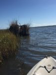 in the wide Mule Slough Lagoon with nary a bite. I decide to explore the eastern shore of the lagoon and the slough channel that connects back to the Gulf, but again without any luck. By now it’s 1 p.m., and I commandeer one of the many duck blinds that dot the lagoon for my lunch time. It feels luxurious. Half an hour later, I’m ready to resume the chase, but by now the wind is really starting to kick up—blowing 15-20 mph ESE and raising small white caps, so I decide instead of fighting the waves I’ll just to float with them
  to the southwest past. That will take me towards another set of islets near Kayak Trail Marker 12 and into Big Pocket, a large cove in Espirito Santo Bay reputed to be good wade fishing. The little islands look good, ringed by marsh grasses and oyster- covered bars—places that usually attract reds. And on the first cast with the root beer curly tail, a strong 20-inch red nails the lure and tows me around in a nice tussle. Over the next 30 minutes, weaving
  around each islet, I catch five more 18-20 inch reds. Experimenting, I also try a gold spoon which nets me a small red and small trout. Then it’s on to Big Pocket, but I come up empty in the good-looking channels connecting the lagoon to the bay and strike out on the Big Pocket shoreline and creeks as I circle back south into the channel between Mule Slough Lagoon and the
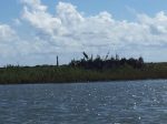 Matagorda Lighthouse
Fish Pond. Note of caution: Make sure you have Google Maps or a GPS app on your smart phone and a good waterproof map (like the Hook-N-Line fishing map for Espiritu Santo Bay) if you venture into this area—and even then it’s easy to get turned around in all the sloughs and channels. There are only two visible landmarks when you’re sitting low in a kayak with tall marsh grass all around—the POC water tower to the north and the Matagorda Island lighthouse to the south.
By now, the tide is running out fairly hard, and I score a dozen or so nice trout  up to 16 inches at the creek mouths along the channel leading into the Fish Pond from Mule Slough Lagoon–where they are stacked up and picking off bait pouring out of the marsh. I do have to switch back to the paddletail when the pesky pinfish start chewing tails off the root beer curly tails. It’s 5:30 p.m., and
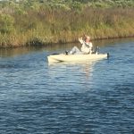 Captain Jim is back waiting for me, so I get to show off a little for him by pulling in a couple of nice trout before we load up and head back to POC. Overall, it’s been a good day—seven reds and two dozen trout. Nothing big, but fun, and not bad for the first time out on a new water. I am already plotting a return trip in a couple of days!
Day 2: October 26
Captain Jim and I are on the water early again, and with the wind much quieter today, I decide to give the Fish Pond a thorough examination. The
 shuttle drop off is again near Kayak Trail Marker 18 at the entrance to Fish Pond. I fool a few small trout in the channel at the same spots I had good results a couple of days ago, all on the four-inch Texas Roach-colored paddletail. Then I start moseying west down the north shore of the broad, shallow Fish Pond, the ESE wind pushing me along slowly. I hit a stretch of
  nice marsh grass edging some oyster beds, and immediately get a 20-inch red. Then I hook bottom…but after a few tugs, the bottom starts to move!! I can tell it isn’t a red or trout, but it is
  definitely strong, and I am not surprised to see a decent-sized flounder come to the surface after a good battle. As I float down the shoreline, I pick up a couple of more reds, then come to a couple of small islands that look good. I loft a cast to the edge of the marsh grass and
  something big rolls on the lure. I set the hook, and he’s off to the races, a good red towing the kayak like a sleigh. As I whisk over an oyster bed, I scatter a half dozen reds that were feeding there. Finally the big guy comes to the boat, a stout 22-incher, the biggest red of the trip so far.
Now I’m at the far west end of the Fish Pond by Kayak Trail Marker 31, and 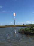 navigate into the channel leading west to Lighthouse Cove. The water is deeper here, and I figure I will get into some good trout holes, but not much is happening. I pick up only a couple of 16-inch trout over the next hour on the white Gulp curlytail as I pass Marker 32 and circle north out of Lighthouse Cove (which has a good hard bottom perfect for wading and lots of good-looking spots) and back through the narrow channels to Marker 31 in the Fish Pond.
By now it’s 3:30 p.m. and my legs are getting a little creaky from sitting most  of the day, so I jump out of the kayak, clip the tow rope to my belt, and take off wading to the east up the south shoreline of the Fish Pond. I am delighted to find the bottom is mostly solid, punctuated with hard sand spits and oyster beds along the marsh grasses that line the banks and shallows. And it’s thigh deep, which seems to suit the reds and trout just fine. I hook and execute a long-distance release on a red who inhaled the white curlytail. I am fan-casting now—making a series of five casts before I move up the shoreline. The first towards the shoreline, about ten feet out, the next further out, and so on till the last one is out into the deeper water to my left (north). I heave a long cast towards the shallower water along the bank something immediately grabs the lure and
  erupts on the surface—it’s a big sea trout! He heads pell mell in the opposite direction, with me in hot pursuit towing the kayak. Then he turns and runs back past me and right under the kayak. I hold my breath, hoping he doesn’t snag on the rudder or pedal fins that extend down below the hull. Somehow he avoids hanging up, and soon I have the twenty-incher for a quick picture and release.
The fishing is steady as I continue up the shoreline, and as the wind lays down, decide to try a surface lure, the venerable Heddon Spook Jr. in a garish “clown” chrome color. Lord knows what the fish think it is! On the third cast towards the shoreline, something blows up on the lure, then streaks off into deeper water. I think big sea trout, but am shocked when I finally bring him in—it’s a 24-inch red, which will be the biggest fish of the trip. Reds are hard to catch on surface lures because their mouths are canted slightly down to expedite their chasing crabs and other delicacies on the oyster beds. To suck in a surface lure, they have to get up on top of it, which is a neat little trick. This is only the second red I have ever caught on the surface!
Now it’s almost 5:15 p.m., and I know the good captain will be waiting for me across the lake and down the channel a bit. I fish for 15 more minutes and net a couple of more nice trout on the white curly tail, then hop in the kayak and pedal back across the Fish Pond. Next time I vow I will just stay in the Fish Pond and cover the other half of the shoreline that I didn’t get to today. Good excuse to come back!! The waters around Port O’Connor are perfect for exploring in a kayak, especially if you can time your visit during the week to avoid the weekend crush.
