August 2024
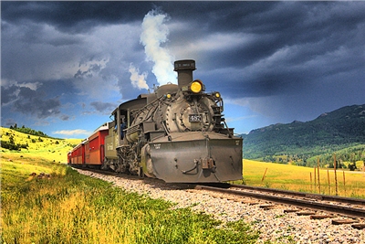
For Day 1 of my most recent search for elusive San Luis Valley cutthroats, see: http://hooknfly.com/2024/08/25/colorados-san-luis-valley-stronghold-of-the-rare-rio-grande-cutthroat/
For a sampling of some other of my Rio Grande Cutthroat adventures in the San Luis Valley, see http://hooknfly.com/2019/09/27/lake-fork-of-the-conejos-river-solitude-in-a-sanctuary-for-rare-rio-grande-cutthroat-trout/ ; http://hooknfly.com/2021/09/14/prospecting-for-trout-on-the-fab-five-forks-of-the-conejos-river-2-the-adams-fork/
Prelude: The comeback story of the endangered Rio Grande Cutthroat is an encouraging one. Once found in waters throughout the Rio Grande River drainage in southern Colorado and northern New Mexico and even in the Pecos River in Texas, its range had shrunk to less than ten percent of the historic area due to a variety of causes like habitat destruction and introduction of invasive species like rainbow and brook trout. But a cooperative effort by government agencies like the federal Fish and Wildlife Service and Colorado Parks and Wildlife as well as conservation groups such as Trout Unlimited has brought this stunningly beautiful fish back from the brink.
One of the pure delights of the angling adventures of this aging septuagenarian fly fisher has been to sample several of the streams in the San Luis Valley like Medano Creek in the Great Sand Dunes National Preserve and the Adams and Lake Fork of the Conejos River that provide safe harbor for this striking, rare fish. I am infatuated with its gorgeous colors and as much by the wild country where the Rio Grande Cutts survive and thrive, streams that you have to work to get to and offer quiet solitude upon arrival.

Given its status, I am extra cautious in following any applicable state regulations (e.g., flies only, catch and release) and handle each catch with extreme care before returning the fish to the water.
Recently, in doing some on-line research about the current status of recovery efforts, I stumbled on a couple of interesting reports from 2008 and 2016 entitled “The Range-Wide Status of Rio Grande Cutthroat Trout.” The 100-page plus studies, put together by a team of state and federal wildlife and land management agencies and the Jicarilla Apache Tribe, identified a host of smaller, little known creeks and streams that were documented as having viable Rio Grande Cutthroat populations along with summaries of efforts to protect and improve habitat for the trout. Illustrative maps depicted the stretches of these waters that held viable Rio Grande Cutthroat populations.
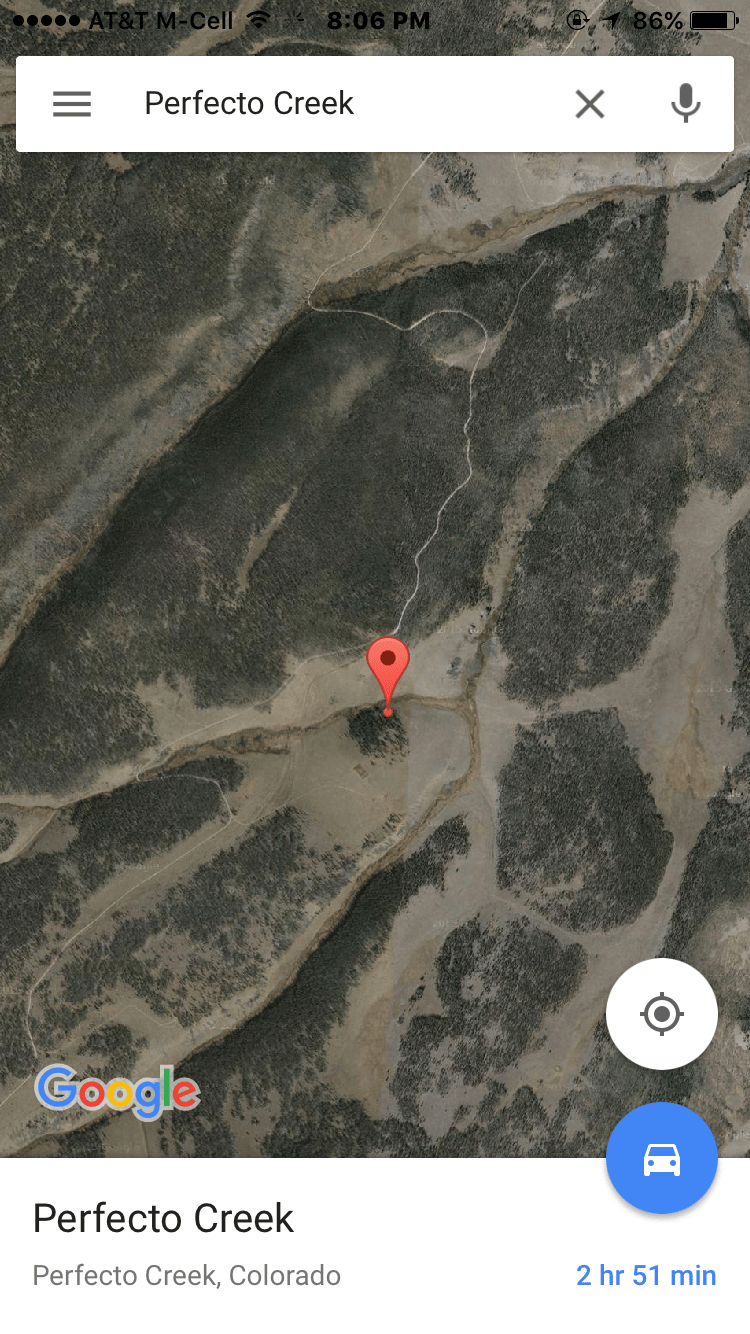
Three caught my eye in Saguache County, Colorado, that marked the northern most range of the Rio Grande Cutthroat—Jacks, Cross, and East Middle Creeks, lying just south of the Continental Divide and the range of the Greenback Cutthroats over the mountains in the Arkansas River drainage. All three are in the drainage of Saguache Creek, on of my favorite trout streams. The reports stated that there were decent populations of the fish—from 150 to 400/mile–in each water with fair but suitable habitat. In one—East Middle Creek, a tributary of Middle Creek—the reports noted the existence of a stream barrier high in the upper sections of the creek such as waterfall or a small dam/drop structure to protect cutthroat populations from intrusion by invasive species like brook trout from below. (cp004 in the map below) These creeks are located close together about a dozen miles or so west of the small town of Saguache and just over an hour’s drive from my cabin near Salida, Colorado. Who could resist exploring? Do those streams still hold the rare Rio Grande Cutthroats?

On Day One of my quest in July, I reconnoitered Cross, Jacks, and Middle Creeks. It was an enjoyable outing, and the brook trout were very cooperative on Middle Creek. (For Day 1 Follies, see http://hooknfly.com/2024/08/25/colorados-san-luis-valley-stronghold-of-the-rare-rio-grande-cutthroat/ ) But the cutthroat proved elusive. I started to question whether any of the cutts existed this far north in the San Luis Valley. Supposedly they survived high up in East Middle Creek, several miles above the confluence with Middle Creek, but I was beginning to have my doubts. The only way to find out was to break out the hiking boots and fly rods and hit the trail.
Day 2: Searching for the Elusive East Middle Creek Cutthroats
A month later in early August, I woke up in the middle of the night in a cold sweat. In a disturbing dream I had fished for days on end nonstop on East Middle Creek, searching for the elusive Rio Grande Cutthroats reputed to be there, but had been skunked time and again. A true angler’s nightmare. From past experience, I knew the only antidote was to plan a trip post haste to East Middle Creek to prove the cutts are really there. And I would need a witness, so in the morning I rang my ace photographer friend Jody Bol to accompany me and document their existence.
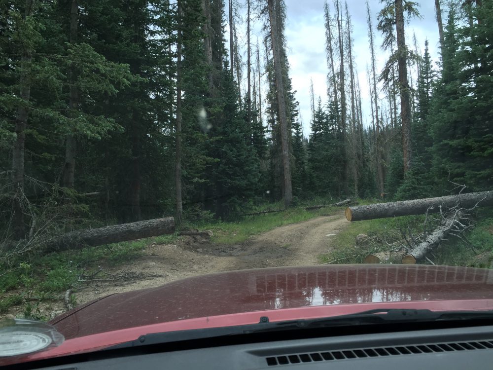
A couple of weeks later we are bouncing up CR 38FF towards the Middle Creek trailhead. The road is rougher in spots than last month and pocked by occasional mudholes from all the rain the area has been getting during the so-called monsoon season—maybe a grand total of a couple of inches, which is substantial for this high mountain valley desert. I have checked the State Of Colorado on-line flow gauge for Saguache Creek downstream as none exist for Middle or East Middle Creeks. It shows that Saguache Creek is running high which may be a good indicator that there will be enough water in the smaller tributaries that are shallow this time of year under normal circumstances.
Soon we come to the trailhead and prepare our gear for what will be a day-long outing of about eight miles roundtrip to the supposed cutthroat lair and back.

I am going to wet wade today so pull on my new Simms Flyweight fishing boots designed for hiking as well as wading. I will be carrying only one rod, a short 7.5 foot wand that should be easier to cast with in the tight quarters of East Middle Creek. I have rigged it with a #16 bushy Royal Stimulator that produced well back in July. It’s a reasonable facimile of the grasshoppers clacking loudly as the flitter about, and more importantly it floats like a battleship and can be seen easily by aging eyes.
We hit the trail around 9:30 a.m. for the first mile of hiking along Middle Creek to the confluence with East Middle where the cutthroat allegedly swim.

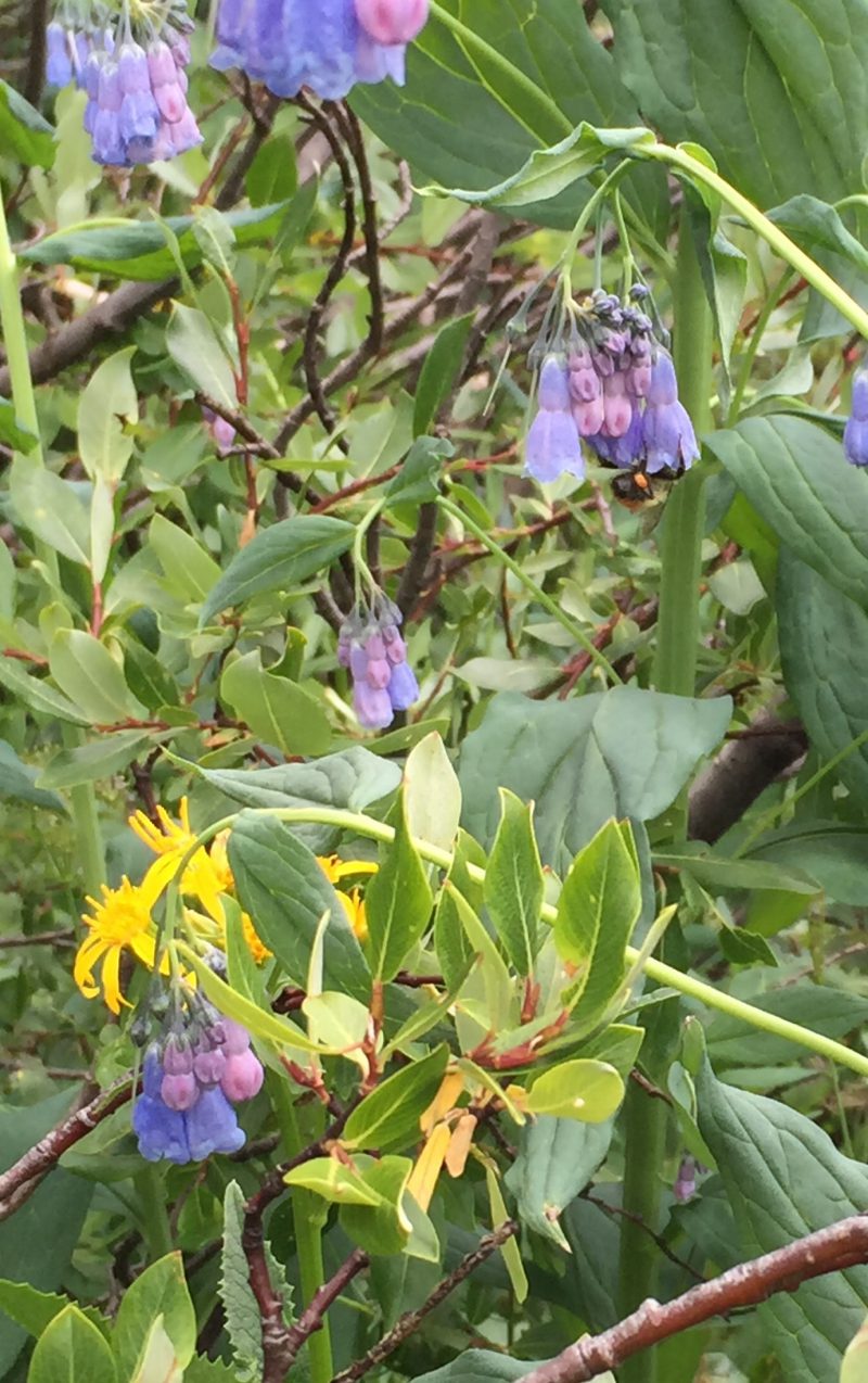
The weather is 60 degrees under a beautiful cloudless Colorado bluebird sky. The trail is a bit damp in spots and lined with an abundance of gorgeous wildflowers—blue asters, dwarf mountain goldenrods, and lupines.


Jody disappears from time-to-time to snap photos. In a herculean exhibition of will, I refrain from sneaking down the slope to Middle Creek where I can see fish rising in the alluring beaver ponds that yielded many will brook trout on my last trip up here in July.

We cover the route to the confluence in about 45 minutes and come to the spot above the confluence where the trail crosses East Middle Creek and then splits. The water is running a bit lower than a month ago but is clear and cold. We decide to take a quick break and a sip from our water bottles. Of course, now I can’t resist at least one cast…ok, maybe a few…into the inviting bend pool! Back in July I caught a scrappy brookie here, but maybe there’s a cutthroat in there fraternizing with the invaders from the eastern USA. My first cast is a bit short, and the fly skirts the edge of the pool in water only a few inches deep. No dice. I lengthen my line a few feet and recast. This time the Stimi alights close against the bank above the pool and swirls enticingly into the deeper water. There’s a flash, and I am onto an lively fish, but alas I can see from its orange trimming that it’s a brook trout.

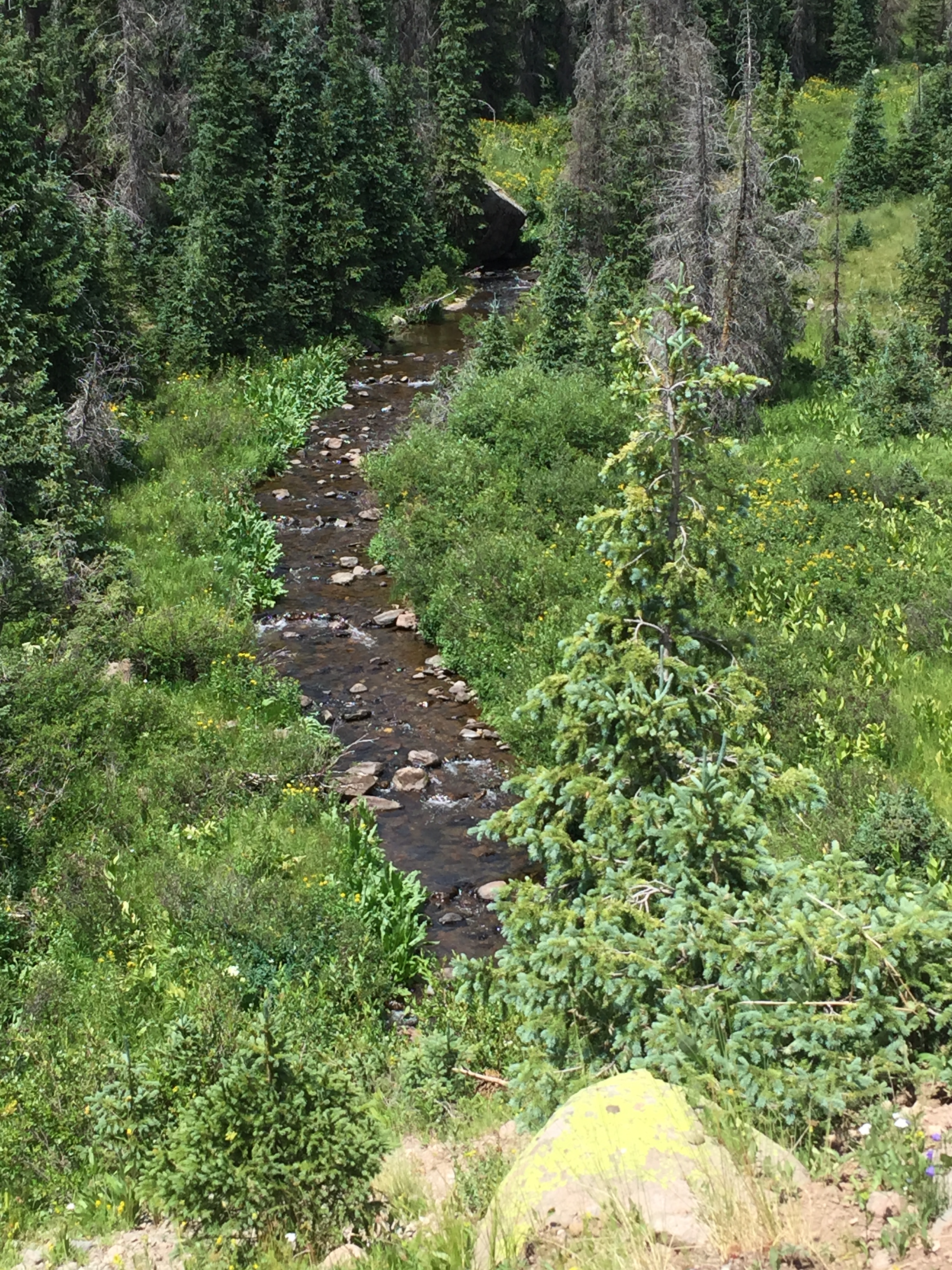
After some quick pix of the spunky fish, we cross over the water and follow the trail a short distance where it splits. To the left would take us to the west back to where the trail intersects and then follows Middle Creek to the north. We turn to the right and hike the trail as it parallels East Creek upstream to the reputed cutthroat water. The hike is a pleasant one with a generally modest grade and a cool breeze blowing. The wildflower show seems to get even more incredible as we climb, carpeting the edges of the trail and slopes with gentle beauty.

Our plan is to descend to the creek whenever we spy a relatively open stretch with sufficient depth and that isn’t overgrown so I can safely cast a fly and that might hold some prized cutthroats. For the first half hour or so, they are few and far between. Most of the creek is hidden in thickets of willows, tree branches, and fallen logs. But where I can find a stretch that has some pools that will provide a hideout for trout and I can manage to thread my casts over logs and dodge overhanging branches or have enough elbow room to try an unorthodox downstream float, the trout are there and hungry. Every short stretch produces two or three. Unfortunately, they are not cutthroats, but chunky brookies that can’t resist the Stimi that they mistake for one of the grasshoppers buzzing about everywhere.


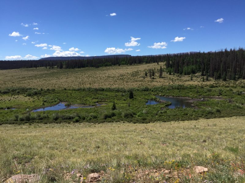
We continue on for another mile, sampling the stream whenever we find a decent-sized opening in the thicket. But it’s more brookies which have taken over the creek en masse. Then just when I am getting despondent about the chances of finding any cutthroats we come to a picture-perfect active big beaver pond complete with a photogenic beaver lodge.

Trout are rising steadily in the center of the pond. The dam is definitely large and high enough that it could be the barrier that stops the brookie invasion. Fearlessly, I start to work my way across the beaver dam to get within casting distance of the risers, all the while doing do my best imitation of a tight-rope walker. To make things more dicey, the beaver have chinked the top of the dam with mud to stop any leaks. Somehow I survive the gooey mess and carefully unfurl a cast that astonishingly avoids snagging in the trees that are lined up below the dam. I let the fly settle then strip it in slowly across the surface. A couple of twitches and the water explodes as a decent-sized fish tries to devour the fly. He misses. I reload and throw another cast that is intercepted in the clutches of a dastardly willow tree behind me. I issue some choice expletives then miraculously pull the offending branch close enough that I can wriggle the fly loose. A good omen, as my next offering alights near where a good fishing has been rising, and he immediately gulps down my offering. My rod bends nicely as the fish jumps then dives for safety of a pile of submerged logs. In preparation for a celebratory cutthroat trout, I do my patented sashaying 360 degree pirouette retrieve, and after a good battle, he relents.


My blood pressure spikes as I await the verdict…. brookie or cutthroat?. Aarghh!! Another chunky brookie has eaten the Stimi!

Five casts and five fish later—all brook trout—I dejectedly begin navigating back across the beaver dam, an impressive high-wire act reminiscent of the famous Flying Wallendas, to renew the search for cutthroats further upstream.
Soon the high peak of Mount Antora, an almost 14-teener, peeks above the horizon signaling the headwaters of East Middle Creek can’t be far ahead.

In another half mile the creek hangs a turn to the south and heads up a steep ravine flanked by the trail high above. My resolve is wavering on whether to continue further up a series of switchbacks when I come to a sign from Colorado Parks and Wildlife featuring a handsome Rio Grande Cutthroat and catch and release regulations. Has to be an good omen so I continue up the switchbacks that climb up the steep slope. Hope springs eternal!

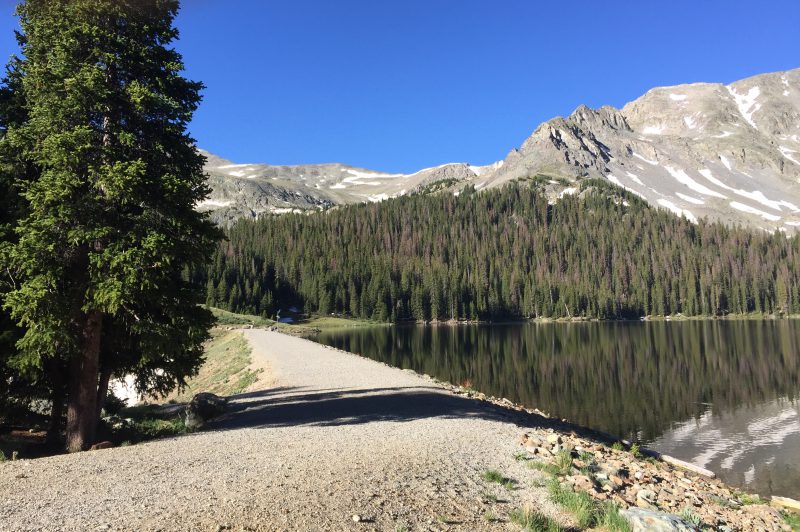
The climb in my heavy wading/hiking boots is no picnic in my now soaking wet, so-call flyweight wading boots. But I can hear the creek roaring over a hundred feet below and can see a series of enchanting clear pools.


Then in the canyon below I spot what we have been looking for—the brook trout barrier in the form of a four-foot waterfall that probably is high enough to stop the invaders.

After the series of steep switchbacks, the trail soon reaches a plateau at almost 10,000 feet elevation then descends a short distance down an easy slope to the creek which is nestled in a small valley above the waterfall. The gradient here is much gentler, and the creek is less overgrown. The casting will still be in tight quarters and there are big logs toppled into the water here and there, but mercifully more open water without the heavy bushwhacking I had to do downstream of the waterfall.
The first pool looks promising and immediately a fish pushing at least two inches bumps the fly with her nose repeatedly, nibbling away. I have to laugh—talk about eyes being bigger than her stomach. I carefully recast a little further up in the pool. This time the fly disappears as a good trout smacks it and dives.

It’s a stout fighter and as it thrashes on the surface looks to be a veritable leviathan of 10-11 inches! The battle continues and I catch a silvery glint as the fish rolls—something you wouldn’t expect from a brook trout. BINGO! As the fish slides closer, I see the hallmark orange slash along its throat, a wild, grand Rio Grande Cutthroat!! I’m beaming—all that trudging and bushwhacking has paid off. A quick photo, and the cutthroat scoots back to his lair.

Now I pause and reflect. It feels like a near-religious experience to gently cradle such a beautiful, rare creature in my hand in the northern most reaches of his kind.

I think of his lineage, a long line of ancestors that have plied these waters through the centuries. Of the Utes and other Native Americans who were stewards of this land and water and how they and the cutthroat trout lived together for decades in a balanced nature before the white man intruded. I take consolation that there is a strong coalition of conservation groups and federal and state agencies like Colorado Parks and Wildlife that are successfully protecting the Rio Grande Cutthroats today and rebuilding its numbers in dozens of waters throughout its range in Colorado and New Mexico. I tip my hat to them and look forward to reporting more in the future about how their handiwork is paying off here on remote East Middle Creek and elsewhere in the San Luis Valley, a gift to future generations.